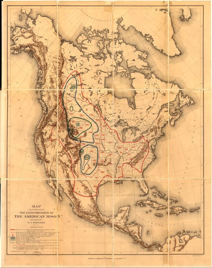
 Hornaday and Gannett’s Map Illustrating the Extermination of the American Bison, 1889. (A digital version here.) They were on the eastern side of the Appalachian chain in the colonial period.
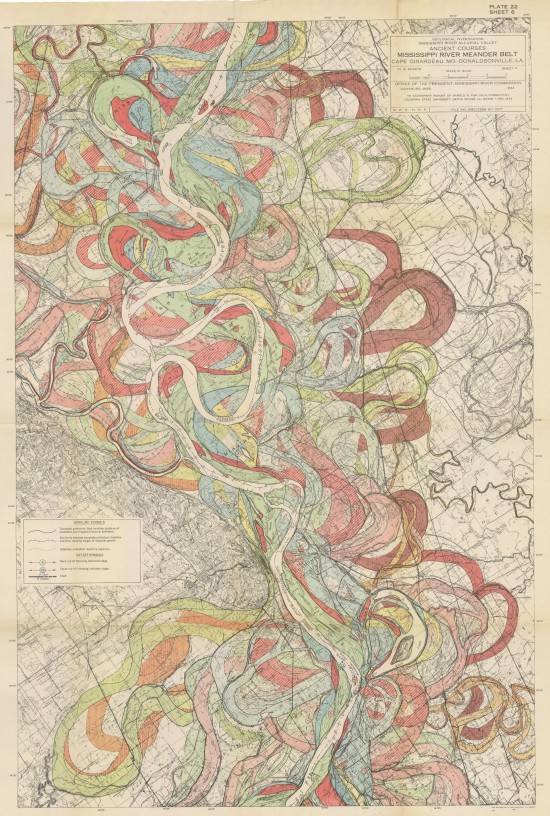 One of the sheets of Harold Fisk’s Ancient Courses [of the] Mississippi Meander Belt, 1944. (More detail here.) 6000 years of sinuous riverine movement. That beast’ll return, by the way, there’s no stopping it. The epic floods this year are only a forecast of things to come as outdated methods of control and old levees are hit with the reality of radical weather. So too the vicious politics: in the great flood of 1927, they saved New Orleans by drowning Greenville. Hundreds of thousands of African Americans were displaced; 50% of the Delta population fled north within a year; it was ethnic cleansing by flood control.
Both of these were found in A History of America in 100 Maps, by Susan Schulten.

Leave a comment